Save money on your next flight
Skyscanner is the world’s leading flight search engine, helping you find the cheapest flights to destinations all over the world.
With postcard-perfect beaches, swaying palm trees, and the iconic Diamond Head crater looming in the distance, Honolulu is the quintessential Hawaiian destination. But just where exactly can you find this island paradise?
If you’re short on time, here’s a quick answer to your question: Honolulu is located on the southeast coast of the island of Oahu in the Hawaiian island chain.
In this comprehensive guide, we’ll dive deeper into Honolulu’s geographic coordinates, position relative to the other Hawaiian islands, location on Oahu, and landmarks that characterize its setting.
The Geographic Coordinates of Honolulu
Latitude and Longitude
Honolulu is located at 21°18′25′′N 157°51′30′′W, giving it a latitude of 21.307° N and a longitude of 157.858° W. This places Hawaii’s capital city on the southern shore of the island of Oahu, overlooking the azure waters of Mamala Bay and Waikiki Beach on the Pacific Ocean.
With balmy trade winds blowing much of the year, Honolulu’s tropical geographic coordinates make it an iconic vacation paradise.
Elevation
Though Honolulu hugs Oahu’s coastline, it has variations in elevation. At sea level right along the beaches of Waikiki, the elevation is essentially 0 feet. Travel inland just a few miles to Honolulu’s downtown, and the elevation increases to around 50 feet above sea level.
The hills above downtown climb even higher, with Punchbowl Crater rising to an elevation of around 500 feet at its rim. So while you can walk from sea level to 500 feet elevation in just a couple miles, most of Honolulu sits low, near the ocean that brought the first Polynesian voyagers to its shores centuries ago.
Honolulu’s Location Within the Hawaiian Island Chain
The iconic capital city of Hawaii, Honolulu, is situated on the southeastern shore of Oahu, the third largest of the Hawaiian Islands. Stretching along the shoreline for approximately 10 miles, Honolulu occupyies an advantageous position about 2,085 miles from California and 3,850 miles from Japan.
Oahu’s Central Position
Oahu holds a central place within the 1,500-mile-long Hawaiian archipelago, which encompasses 137 islands, reefs and shoals. The eight main islands from northwest to southeast are Niihau, Kauai, Oahu, Molokai, Lanai, Kahoolawe, Maui and Hawaii (also known as the Big Island).
As the most densely populated island, Oahu is home to approximately 975,000 residents, with Honolulu accounting for about 70% of that total. The desirable location and infrastructure of Oahu have made it an economic and transportation hub for the state.
Strategic Harbor Location
Honolulu’s harbor sits on the south shore of Oahu, protected by coral reefs and several small islands. This strategic position enabled King Kamehameha I to unify the Hawaiian Islands in the late 18th century after conquering Oahu and taking control of its vital harbor.
The sheltered harbor continues to handle major maritime traffic as the principal port of entry for Hawaii. The commercial port manages around 80% of all goods imported into the state from the mainland U.S. and foreign countries.
Tourism Gateway
In addition to commercial shipping activities, the bustling harbor serves Hawaii’s enormous tourism industry. Cruise ships dock at piers along the harbor front, which sits adjacent to the tourist hotspots of Waikiki Beach, Ala Moana Center and the Hawaii Convention Center.
As Hawaii’s aviation hub, Honolulu International Airport processes thousands of domestic and international flights each year. Convenient connections to Asia and North America have enabled Honolulu to become the gateway for most air travelers visiting Hawaii.
From its advantageous harborside location to its busy international airport, Honolulu serves as the beating heart of tourism within Hawaii, connecting the archipelago with major hubs across the Pacific and around the world.
Pinpointing Honolulu on the Island of Oahu
Position on Oahu
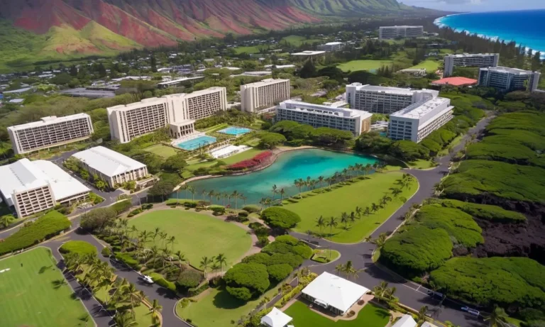
The vibrant city of Honolulu is situated along the southeastern shore of the island of Oahu, which is the most populous of the Hawaiian Islands. More specifically, Honolulu stretches across an area spanning approximately 85 square miles, nestled between the Pacific Ocean to the south and east and the Koʻolau mountain range to the north.
As the state capital and largest city in Hawaii, Honolulu acts as an economic and transportation hub for business, tourism, education, and much more. Its strategic seaside location on Oahu has facilitated the growth of Honolulu into a globally-connected modern city over the past two centuries.
Bordering Neighborhoods and Geographic Features
Honolulu borders several distinct neighborhoods along both its coastal edges and its inland mountain-facing districts. To the west, neighborhoods like Iroquois Point and ʻEwa Beach line Honolulu’s shoreline and suburbs, while the famous Waikīkī Beach district sits just to the east.
Inland from Waikīkī, the Ala Moana and Kakaʻako neighborhoods comprise Honolulu’s central urban districts before you reach the foot of the verdant Koʻolau Mountains. Prominent peaks overlooking Honolulu include Mt. Tantalus (Puʻu ʻŌhiʻa) and the Round Top Drive lookout.
On Honolulu’s eastern flank, the beach town of Hawaii Kai nestles around scenic Maunalua Bay, with the iconic volcanic cinder cone known as Koko Head prominently presiding over the area. Heading further east takes you along Oahu’s fabled North Shore, lined by the renowned surf breaks of Sunset Beach, Banzai Pipeline and Waimea Bay.
Iconic Honolulu Landmarks and Their Settings
Waikiki Beach
Waikiki Beach is a world-famous 2 mile stretch of white sand beach on the south shore of Oahu, known for its stunning views of Diamond Head. Its turquoise waters and rolling waves create ideal conditions for surfing, outrigger canoeing, standup paddleboarding and swimming.
The beach fronts Waikiki’s lively tourist district filled with hotels, restaurants, shops and entertainment.
Diamond Head
The iconic Diamond Head volcanic crater sits just to the east of Waikiki, creating unmistakable views from the famous beach. The 0.75 mile hike to the crater’s 761-foot summit offers sweeping 360-degree views of Waikiki, Honolulu city and the blue Pacific.
Its proximity to Waikiki makes Diamond Head one of the most visited and photographed volcanic cones on Earth.
Koko Head
On Oahu’s eastern tip, the views from atop Koko Head’s 1,200-foot sea cliffs showcase the island’s rugged natural beauty with towering volcanic peaks, lush valley waterfalls and the crashing blue Pacific below. The unique setting allows both sunrise and sunset views.
The trailhead sits in former military bunkers just a 15 minute drive from world-famous Hanauma Bay.
Ala Moana Beach Park
Located between Waikiki and Honolulu’s downtown, Ala Moana Beach Park is one of Hawaii’s most popular beach parks. Its calm swimming lagoons contrast with wave-filled outer reefs, creating safe family conditions. The park hosts 4 million annual visitors across its 1.5 mile shoreline.
Spectacular views of the Honolulu skyline like the Aloha Tower make Ala Moana a quintessential Hawaiian postcard backdrop.
Conclusion
From its exact latitude and longitude to the slopes of Diamond Head visible from Waikiki Beach, this guide leaves no stone unturned in answering the question: Where exactly is Honolulu, Hawaii? We’ve explored its geographic coordinates, position among the Hawaiian islands and on Oahu specifically, and even toured iconic landmarks within the city.
The next time you voyage across the Pacific to Oahu, use this deep dive on Honolulu’s location to get your bearings and make the most of your Hawaiian adventure.